EPSG
The European Petroleum Survey Group (http://www.epsg.org) maintains a freely available database with standard codes for coordinate systems, datums, spheroids, units and such like. Additionally, this database contains the parameters for these objects or - if they cannot easily be expressed as values - at least references to where such parameters can be found. This database is the standard “authority” used by many GIS-related programs and projects such as, for example, OpenGIS standards, GeoTools and GeoTiff and its related projects.
Since some members of the EPSG also worked on the OGC CTS specifications, the OGC CTS API closely matches the EPSG database schema.
This database has a high value for the GIS community for the following reasons:
Since every geographic object (coordinate system, spheroid, unit etc.) gets assigned a unique number, different programs can easily exchange information. The sending program sends the point(s) or features together with a horizontal or projected coordinate system code and the receiving program knows precisely where to place the points or features on the earth.
The database is under active maintenance. The official release at the time of writing (April 2004) is v6.5. EPSG puts a lot of effort into ensuring downward compatibility. For example, one code will never change its meaning or parameters. If errors are found, the code gets deprecated and the object gets assigned a new code if necessary. However, there are still major structural changes ongoing - together with a increase in the number of objects cataloged and some objects being deprecated. EPSG, therefore, is far from being considered “final” or “nearly final”. Still, this database can be considered unavoidable when working with and exchanging geographic information.
The database contains coordinate systems and their components, coordinate transformations and their details (e.g. Bursa Wolf transformation parameters) as well as a table with units of measure and a list of predefined queries. For more information about its structure and contents, see GEOTOOLS:A structural comparison of coordinate system concepts.
You can download the database (in MS Access 97 and SQL scripts) from http://www.epsg.org.
For Windows installation HowTo’s see their documentation and for Linux see our documentation for the
gt-epsh-postgres plugin.
EPSG also maintains some “Guidance notes” on coordinate references systems, map design naming and similar topics.
GeoTools
GeoTools follows OpenGIS specifications. This applies particularly to the
org.geotools.referencing package and
our coordinate transformation services. Since these specifications are very flexible, so are the
GeoTools implementations.
For example GeoTools can handle:
Geographic coordinate systems that use
(lat, lon)as well as(lon, lat);Geographic coordinate systems whose axes increase to the west and south; and
Coordinate systems of every possible unit of measure: degree, radians, grad, meter, inch, feet, and all other more uncommon units used in certain countries.
However this means that it cannot be assumed by the user that a geographic CRS is always (lat, lon)
with degrees and axes increasing to north and east although this is mostly the case in North America
and Europe. It it always necessary to verify and respect the coordinate system properties, that
the specific coordinate system object provides!
There exists a WGS84 constant which defines the commonly used geographic CRS. It is defined as being
(lon, lat), using degrees, having axes increasing to north and east and using the WGS84 geodetic
datum - which itself is defined as a constant in GeoTools. Since many Bursa-Wolf parameters define
a transformation between a geographic CRS and WGS84, a transformation between two geographic CRS
would (only using Bursa-Wolf transformations), for example, work as follows: User selected input
geographic CRS -> WGS84 (constant) -> user selected output geographic CRS.
GeoTools version 2.0 followed the OpenGIS specification 01-009 (Coordinate Transformation Services (CT)).
GeoTools 2.1 and latter use the more recent coordinate system concepts described in the OpenGIS abstract specification 03-073r1 (Spatial Referencing by Coordinates).
Although the EPSG database already contains the new structures described therein, the database v6.x can be used by GeoTools without problems - the EPSG factory takes care of all the details. But what are these differences actually? This is the topic of the following chapter…
Comparison
Geographic coordinate systems are quite complex, and their creation, coordinate transformations and storage are not straightforward at all. This chapter will help to explain the underlying structures as it describes the state-of-the-art concepts regarding geographical coordinate systems and their parts as, for example, geodetic datums and ellipsoids.
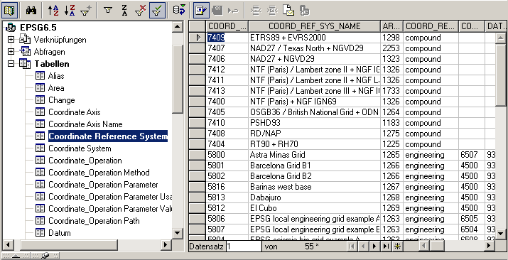
In order to gain a better understanding, it is recommended that you have the EPSG database installed. Choose a database viewer and have a look at the database.
Note
Just in case you don’t have a good viewer at hand, OpenOffice does a good job of viewing the database. You will have to register the database under Extras->Data sources as an ODBC database. Then, in any document, press F4 to open the database window. Now you can easily browse the database’s tables.
You should see a structure like the one in the following screenshot:
You will soon see that the database (v6.x) has a hierarchical structure that is equal to the new OpenGIS abstract specification Spatial Referencing by Coordinates. The “old” OpenGIS specification Coordinate Transformation Services (CT) had a slightly different structure - as had the “old” EPSG databases v5.x. The following paragraphs give a simplified overview of these hierarchies.
EPSG6.x
The new EPSG database, in contrast to older approaches, distinguishes between coordinate systems (CS) and coordinate reference systems (CRS).
A CS is a coordinate system in the mathematical sense. There are cartesian CS for flat things like maps, ellipsoidal CS that describe an ellipsoid and geocentric CS which have their origin at the center of the ellipsoid (the earth).
On the other hand, a CRS is a specific implementation of such a CS with additional parameters that pin the CS to the earth. In other words, while a CS is general, a CRS is specific to describing locations points on/in/above the earth.
Projected Coordinate Reference System (CRS)
“Cartesian” Coordinate System (CS): Axis Info
Projection
“Geographic2D” Coordinate Reference System (CRS)
“Ellipsoidal” Coordinate System (CS): Axis info
Geodetic datum: which defines the conversion to WGS84
Ellipsoid: Linear unit of measure, Semi-major axis, Inverse flattening OR Semi-minor axis
Prime Meridian: Angular unit of measure, Greenwich longitude
EPSG5.x
“Projected” Coordinate System
Axis info
Projection
- “Geographic2D” Coordinate System: Axis info
Geodetic datum: which defines the conversion to WGS84
Ellipsoid: Linear unit of measure, Semi-major axis, Inverse flattening OR Semi-minor axis
Prime Meridian: Angular unit of measure, Greenwich longitude
EPSG v6.x structure in more detail
In the following hierarchical structure, columns that merely serve for description or database maintenance have been omitted for clarity.
“Projected” Coordinate Reference System (CRS)
AREA_OF_USE_CODE
COORD_REF_SYS_KIND = “projected”
COORD_SYS_CODE
COORD_SYS_TYPE =”cartesian”
DIMENSION (1 to 3)
COORD_AXIS_NAME_CODE , …_ORIENTATION and …_ABBREVIATION for each axis
UOM_CODE for each axis
ORDER for each axis
PROJECTION_CONV_CODE
SOURCE_GEOGCS_CODE (= Geographic2D Coordinate Reference System)
AREA_OF_USE_CODE
COORD_REF_SYS_KIND = “geographic2D”
COORD_SYS_CODE
COORD_SYS_TYPE =”ellipsoidal”
DIMENSION (1 to 3)
COORD_AXIS_NAME_CODE , …_ORIENTATION and …_ABBREVIATION for each axis
UOM_CODE for each axis
ORDER for each axis
DATUM_CODE
DATUM_TYPE = “geodetic”
ELLIPSOID_CODE
UOM_CODE
SEMI_MAJOR_AXIS
INV_FLATTENING or
SEMI_MINOR_AXIS
ELLIPSOID_SHAPE = mostly true
PRIME_MERIDIAN_CODE
GREENWICH_LONGITUDE
UOM_CODE
AREA_OF_USE_CODE